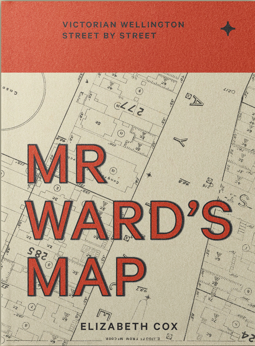
Massey University Press have just published my new book, a must-have for all passionate Wellingtonians: Mr Ward’s Map: Victorian Wellington street by street.
Mr Ward’s Map is a fascinating and lively street-by-street social history of Wellington in the pivotal years of growth from 1890 to 1900, all documented in 88 sheets (roughly A1 in size) drawn for the city council by surveyor and engineer Thomas Ward.
The map stretched from Thorndon in the north to Berhampore in the south, taking in the teeming inner-city areas of Te Aro and Newtown, the grand homes of Thorndon and The Terrace, the remnants of Māori kāinga (settlements), the Town Belt, Basin Reserve, the ‘lunatic asylum’ and hospital, the city’s emergent suburbs, reclaimed land, and every street in between.
The map recorded the exact footprint of every building in the city — every commercial building and every house, every garden shed, stable and outdoor toilet. As well as a building’s shape, Ward recorded the number of its rooms and storeys, and what its walls and roof were made of. He even recorded the location of electric street lights and the ‘fire plugs’ for the hoses of the city’s fire brigade. I have used the map to tell the social history stories of the city at the end of the 19th century.
The book is a beautiful large hardback – 570 pages long! In addition to the maps, it is bursting with wonderful photographs, paintings, circus and opera programmes and more.
The book is now available in all good bookshops, including Unity Books, or from the publisher here: https://www.masseypress.ac.nz/books/history/mr-ward-s-map
or if you’re not in New Zealand, you can get it from Amazon.
Check out some of the reviews of the book on my post here: It’s in the shops!
Framed maps
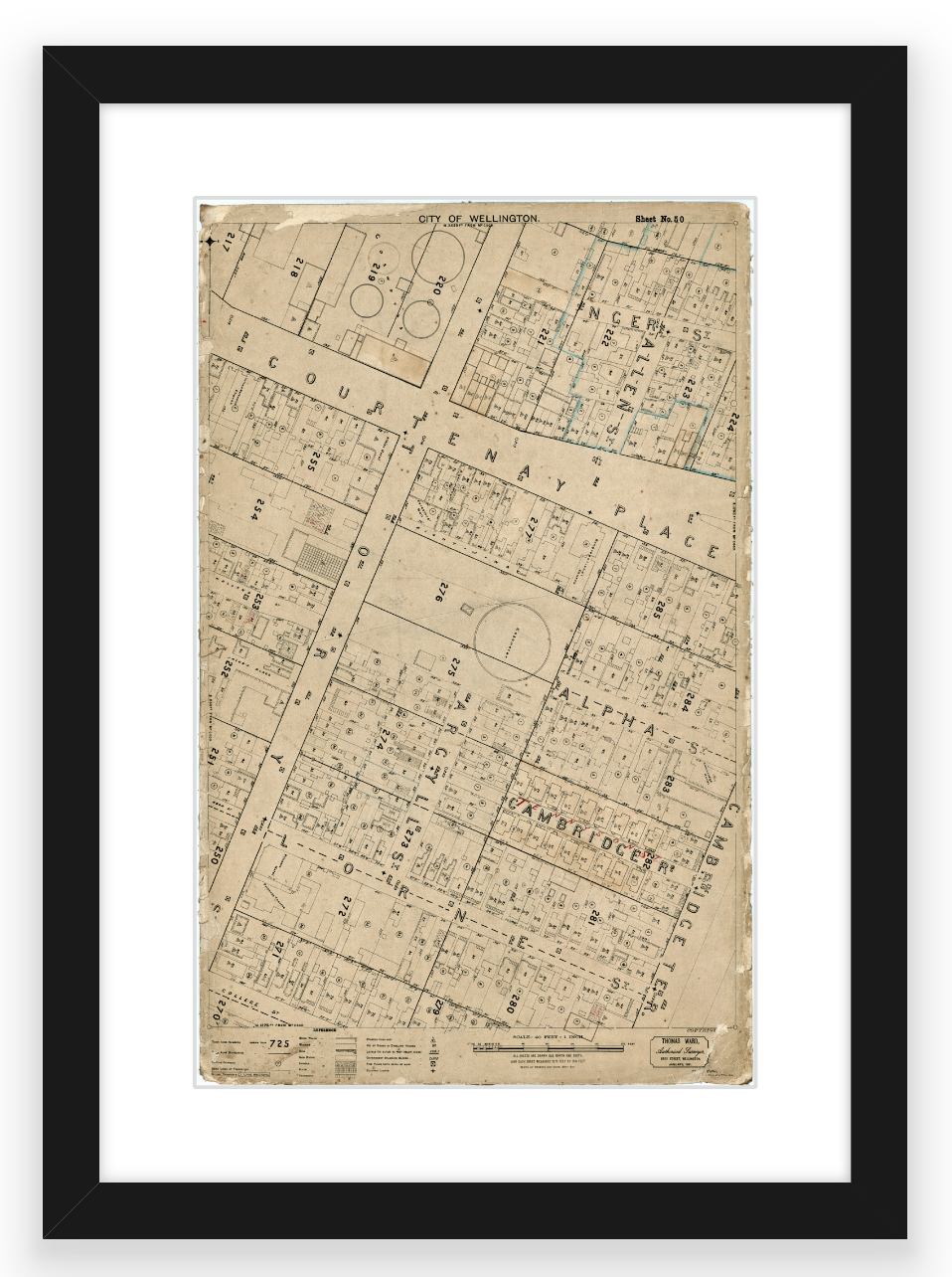
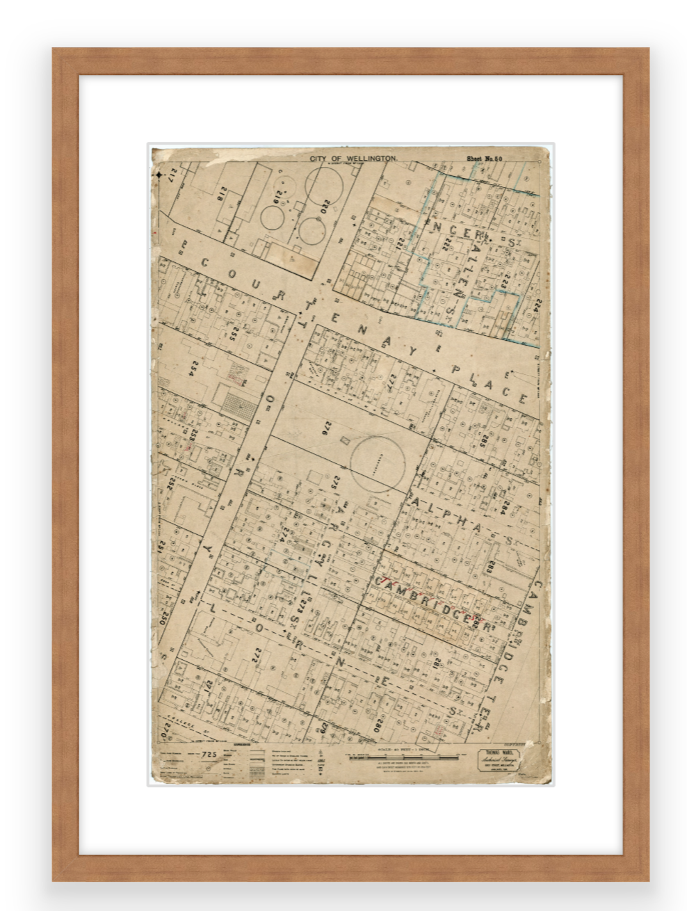
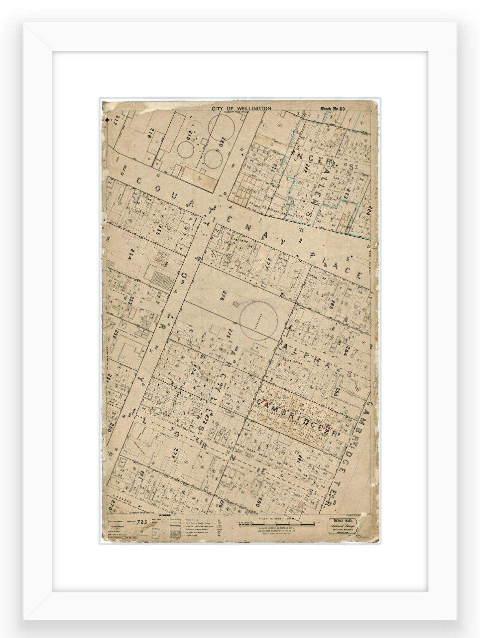
To support the substantial cost of publication, we are selling framed copies of individual sheets from the map. I am offering a personalised service – I will be happy to assist you to choose which is the best map for you – for example your home, workplace or favourite spot in the city. I can research which is the best map sheet for you and send you options to choose from. If you live in a pre-1900 house in Wellington, I should be able to help you locate it on the maps.
The map includes the following suburbs:
Thorndon — Mount Victoria — Oriental Bay
Te Aro Flat, Lambton Quay and the CBD
Mount Cook — Aro Valley
Newtown — Berhampore
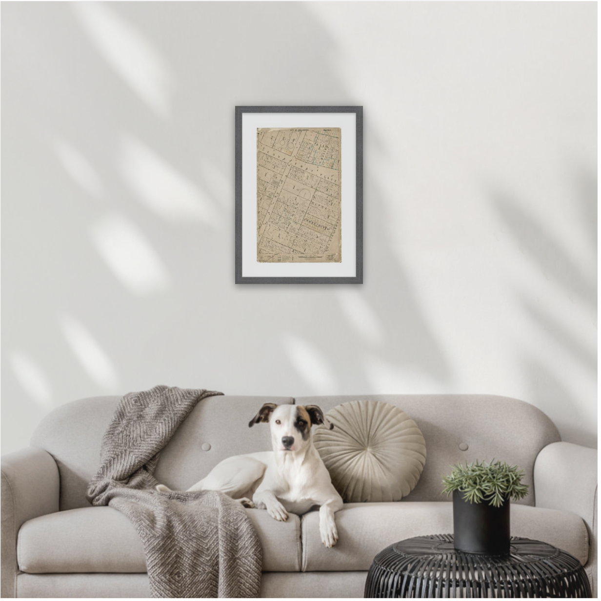
Framing options:
There are a number of framing options – let me know which you would prefer.
All frames are sustainably sourced, solid wood frame, handmade in New Zealand.
All the maps are roughly 280mm x 450mm (roughly A3) – and with the mat and frame are roughly 440mm × 560mm.
Glazing: Standard Glass
Includes: Mat (50mm) & wire/D-rings for hanging
Printing: Enhanced Matte
PRICE: $200 plus courier postage (eg $14 to the North Island)
PRICE: $200 plus courier postage (eg $14 to the North Island)
PRICE: $200 plus courier postage (eg $14 to the North Island)
PRICE: $200 plus courier postage (eg $14 to the North Island)
CHOCOLATE BROWN WOOD FRAME
PRICE: $200 plus courier postage (eg $14 to the North Island)
To contact me and talk through the options, please fill out the form below.
No need to pay until we have worked out which map is best for you:


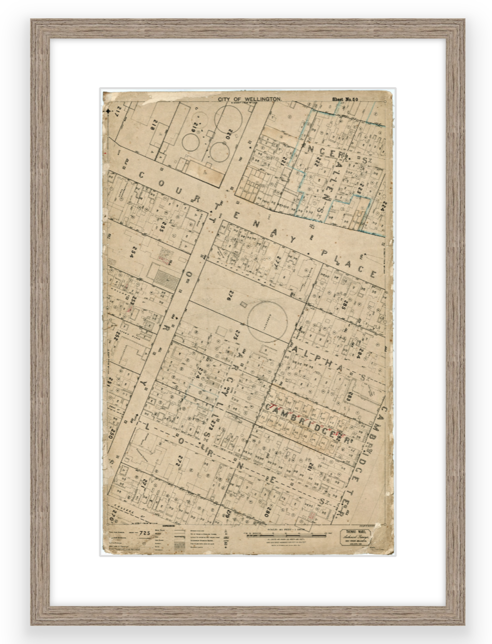
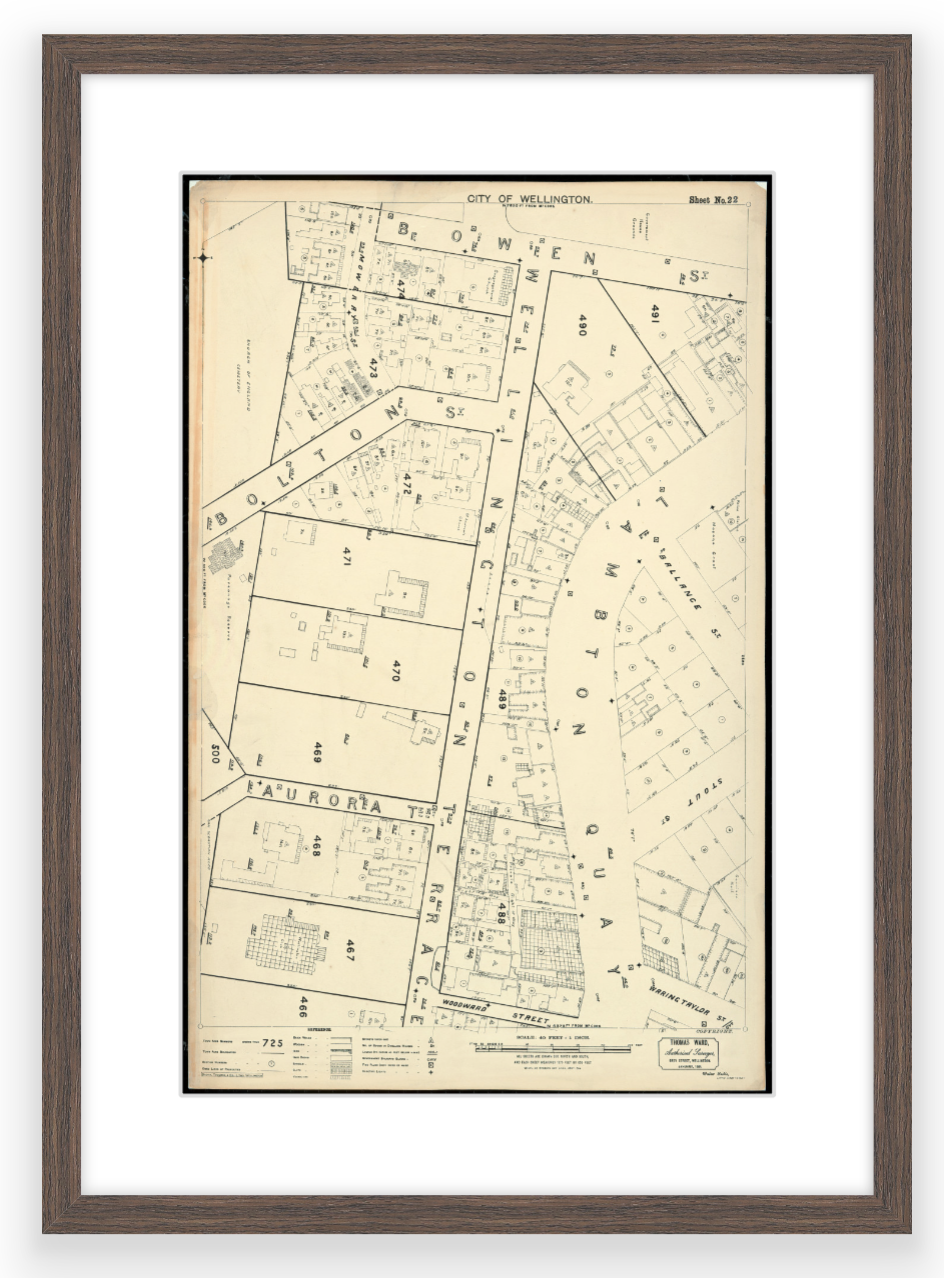
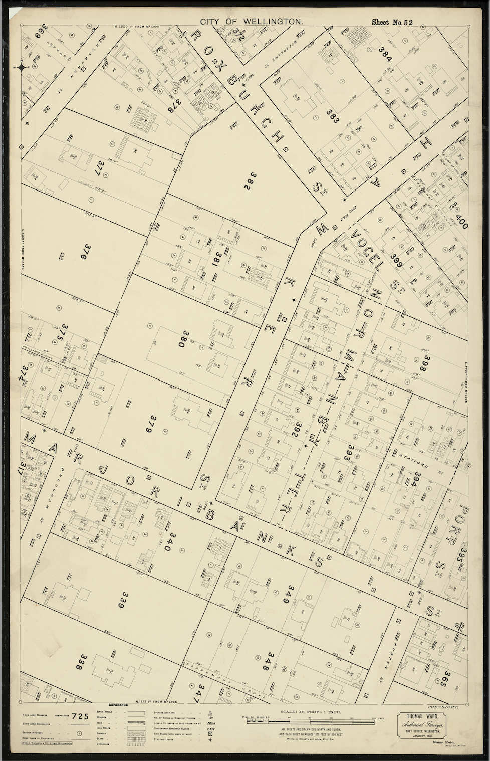
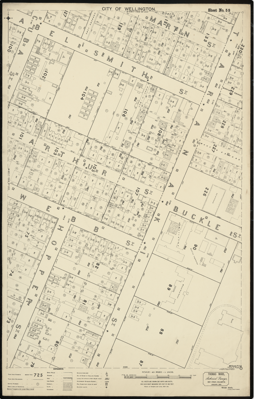
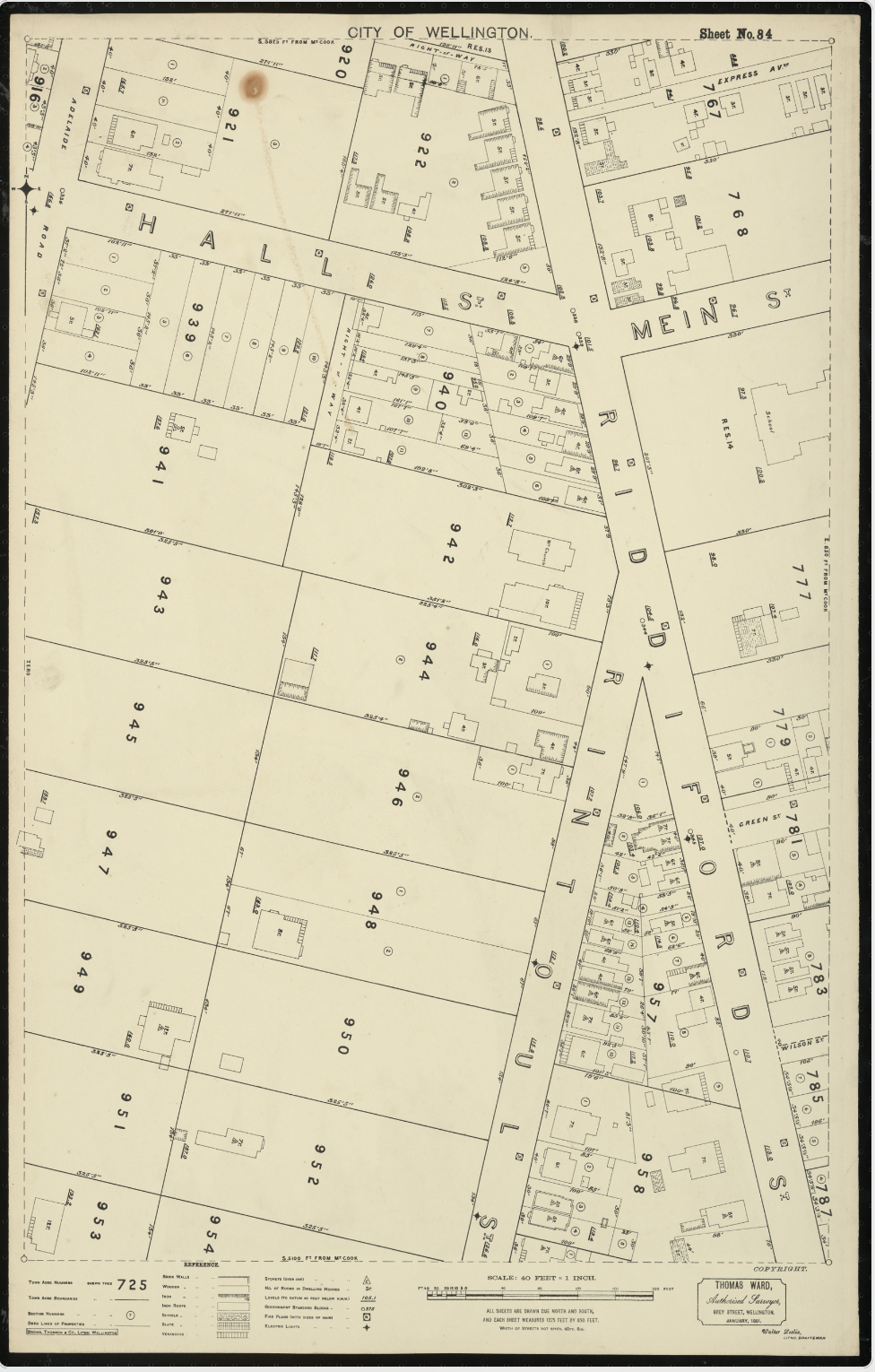
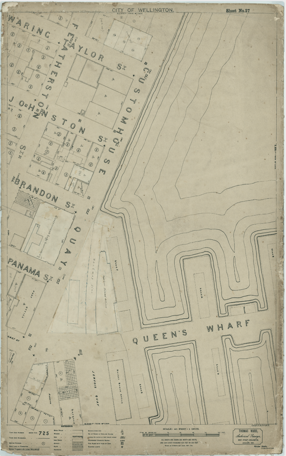
Here are examples of just some of the 88 maps that are available:
Marjoribanks / Hawker Street
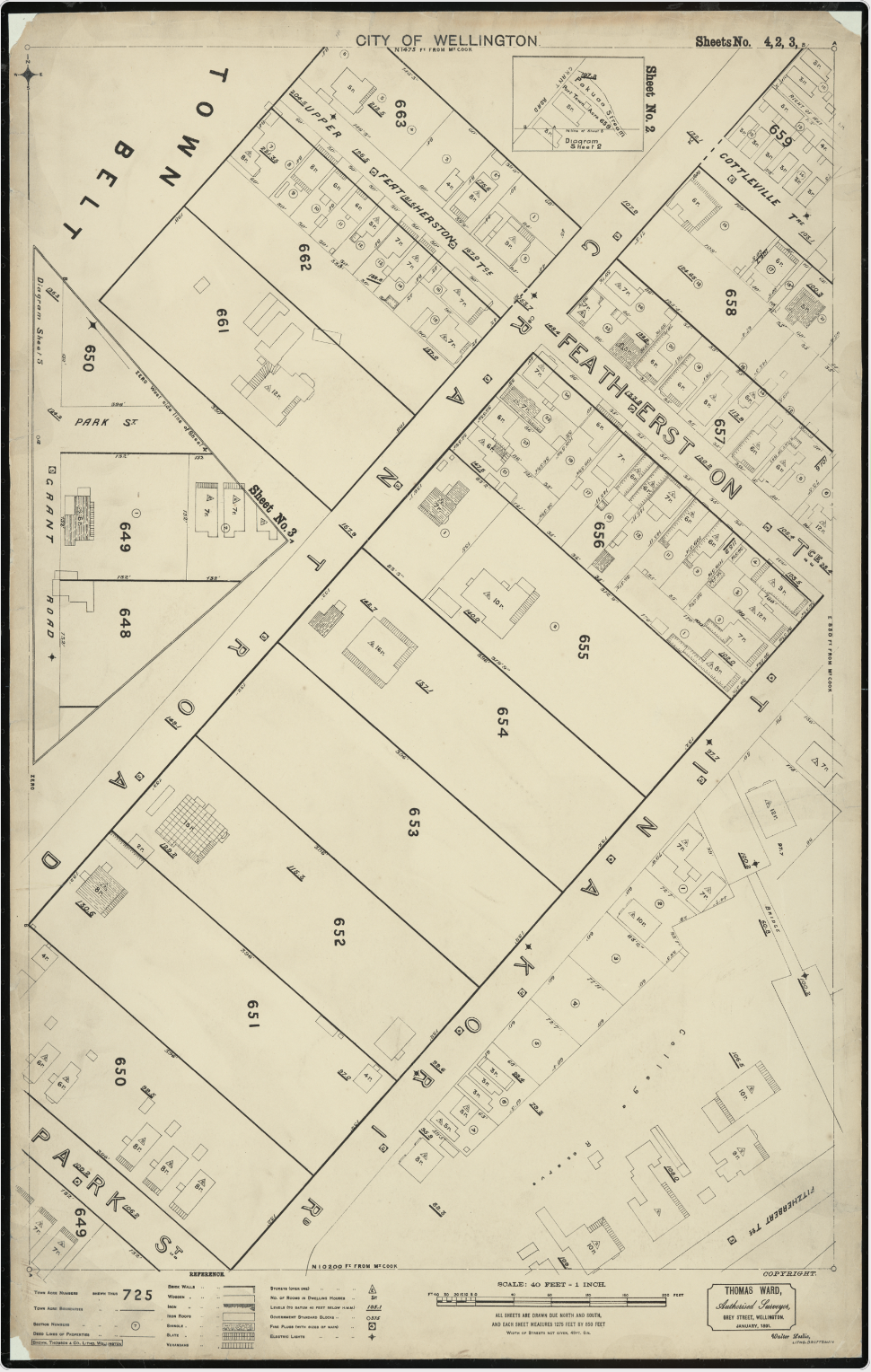
Tinakori Road etc
Riddiford / Rintoul Street junction

NEW OFFER!!
I now have a Thomas Ward-drawn survey map for the Wellington suburb of Northland for sale. It is a bit different from the other Ward maps I wrote the book about, as it was drawn for the developers of the suburb when it was new as an advert for the sections, so doesn’t show houses – but it does show the streets, and the sections. It is a beautiful map, and will frame up really nicely. The frame options are the same as above – and the size is roughly the same (roughly A3 in size). I have a very high-res version for printing.
Please contact me using the survey form above if you are interested in any of the maps.
